


AVON 49 Voting District, Lake County, Illinois
About
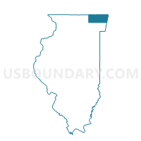
Outline

Summary
| Unique Area Identifier | 572302 |
| Name | AVON 49 Voting District |
| County | Lake County |
| State | Illinois |
| Area (square miles) | 2.20 |
| Land Area (square miles) | 2.11 |
| Water Area (square miles) | 0.09 |
| % of Land Area | 95.90 |
| % of Water Area | 4.10 |
| Latitude of the Internal Point | 42.34046220 |
| Longtitude of the Internal Point | -88.10578260 |
Maps


Graphs
Select a template below for downloading or customizing gragh for AVON 49 Voting District, Lake County, Illinois


Neighbors
Neighoring Voting District (by Name) Neighboring Voting District on the Map
- AVON 35 Voting District, Lake County, IL
- AVON 452 Voting District, Lake County, IL
- AVON 463 Voting District, Lake County, IL
- AVON 50 Voting District, Lake County, IL
- FREMONT 455 Voting District, Lake County, IL
- GRANT 137 Voting District, Lake County, IL
- GRANT 456 Voting District, Lake County, IL
- WAUCONDA 343 Voting District, Lake County, IL
Top 10 Neighboring County Subdivision (by Population) Neighboring County Subdivision on the Map
- Avon township, Lake County, IL (65,001)
- Fremont township, Lake County, IL (32,337)
- Grant township, Lake County, IL (26,523)
- Wauconda township, Lake County, IL (21,730)
Top 10 Neighboring Place (by Population) Neighboring Place on the Map
Top 10 Neighboring Elementary School District (by Population) Neighboring Elementary School District on the Map
- Grayslake Consolidated Community School District 46, IL (30,258)
- Fremont School District 79, IL (19,330)
- Big Hollow School District 38, IL (14,379)
Top 10 Neighboring Secondary School District (by Population) Neighboring Secondary School District on the Map
- Grayslake Community High School District 127, IL (44,566)
- Mundelein Consolidated High School District 120, IL (42,836)
- Grant Community High School District 124, IL (36,905)
Top 10 Neighboring Unified School District (by Population) Neighboring Unified School District on the Map
- Round Lake Community Unit School District 116, IL (36,361)
- Wauconda Community Unit School District 118, IL (27,202)
Top 10 Neighboring State Legislative District Lower Chamber (by Population) Neighboring State Legislative District Lower Chamber on the Map
Top 10 Neighboring State Legislative District Upper Chamber (by Population) Neighboring State Legislative District Upper Chamber on the Map
Top 10 Neighboring 111th Congressional District (by Population) Neighboring 111th Congressional District on the Map
Top 10 Neighboring Census Tract (by Population) Neighboring Census Tract on the Map
- Census Tract 8641.01, Lake County, IL (11,442)
- Census Tract 8642.05, Lake County, IL (9,075)
- Census Tract 8609.06, Lake County, IL (8,937)
- Census Tract 8614.02, Lake County, IL (8,679)